1) submarine cable route planning


海缆路由设计
1.
The application of GIS to cable route design becomes our new choice,because the design of submarine cable route planning is complex,many-dimensional,dynamic and the traditional plane design is not visual and intuitionistic.
文章介绍了GIS技术的发展现状、关键技术,归纳了海缆路由设计的流程、对象,重点对GIS技术在海缆路由设计中的应用进行探讨,并指出基于3D GIS技术的海缆可视化路由设计是发展趋势。
2) submarine cable route area


海缆路由区
1.
The distributions of seabed soil and the tidal current characteristics in the Beihai-Lingao section submarine cable route area in the Qiongzhou Channel are acquired by analyzing the field survey and indoor test results,and the possibilities of soil mass failure in the cable route area due to 10 year and 50 year return period tidal currents are calculated and analyzed.
通过野外勘察和室内试验分析结果,了解琼州海峡北海—临高段海缆路由区浅层海底土分布特征和路由区及其附近海区的潮流特征,利用计算的方法分析了10 a和50 a一遇的潮流对海缆路由区冲刷破坏的可能性。
2.
Based on the near-surface sediment distributions and physicomechanical characteristics in the Qiongzhou Strait Beihai to Lingao submarine cable route area and the earthquake data observed in the cable route neighbouring area,the possibilities of liquefaction or slide of seabed soil at depths less than 3 m in the route area under the earthquake actions are computed and analyzed.
通过野外勘察和室内试验分析,了解琼州海峡北海—临高段海缆路由区浅层沉积物分布和物理力学特征。
3) subsea pipeline and cable route


海管海缆路由
4) routing design


路由设计
补充资料:海陵岛银海城十里银滩风景旅游区

海陵岛银海城十里银滩风景旅游区
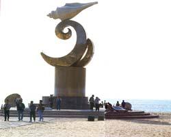
海陵岛银海城十里银滩风景旅游区位于广东省阳江市海陵岛南面,滩长8000米,平均宽150米,是海 陵岛最大的海滩。银海城旅游度假区三面环绕着翠岭青山,南面延伸着洁白宽阔的沙滩,阳光白沙、碧浪 青山交织出一幅亚热带风情画卷。旅游风景区包括四个部分:皇宋螺城、宾馆别墅区和海滩公园浴场区。 宾馆别墅区以主题区建筑模式进行规划,设有民族别墅苑、苏州苑、太空城、蒙古城等若干组,汇集中国 多种民族建筑风格,目前民族苑已建成5套座,其他类型别墅3座,在沙滩公园还建有牛仔美食城、啤酒屋 以及64栋木结构沙滩情侣屋。
说明:补充资料仅用于学习参考,请勿用于其它任何用途。