1) Qiadam basin


柴达达木盆地
2) Qaidam Basin


柴达木盆地
1.
Distribution characteristics and controlling factors of depositional systems of the Neogene Xiayoushashan Formation in Hongliuquan—Yuedong area,Qaidam Basin;
柴达木盆地红柳泉—跃东地区新近系下油砂山组沉积体系展布特征及控制因素
2.
Assessment of biogas resource in Quaternary in Qaidam Basin;


柴达木盆地第四系生物气资源量预测
3.
Queries about biogenesis of Quaternary gas in Qaidam Basin,NW China;


柴达木盆地第四系生物成因气质疑
3) The Qaidam Basin


柴达木盆地
1.
Development of decision-support system for water resources planning and management in the Qaidam Basin,Qinghai,China;
柴达木盆地水资源决策支持系统的设计与开发研究
2.
A comparison on the climate evolution between the Qaidam Basin and Pearl River Delta since the Late Quaternary;
柴达木盆地与珠江三角洲地区晚第四纪气候变化比较研究
3.
Analyses of Land Resources and Sustainable Use of Land in the Qaidam Basin Based on GIS;


柴达木盆地土地资源的利用现状及可持续利用
4) Chaidamu Basin


柴达木盆地
1.
The Electrical Recognition Criteria for the Petroleum in E_3~1、E_3~2、N_2~2 Reservoirs in the Qigequan Field, Chaidamu Basin;
柴达木盆地七个泉油田E_3~1、E_3~2、N_2~2油气电性识别标准
2.
Fracture activities and hydrocarbon accumulation in Pingdingshan area of Mahai,Chaidamu basin.;
柴达木盆地马海平顶山区断裂活动与油气运聚
3.
Oil source correlation of east member,north edge in Chaidamu basin;


柴达木盆地北缘东段油源对比
5) Caidamu Basin


柴达木盆地
1.
Characteristics of the late hydrocarbon accumulation of the Tertiary in the western Caidamu Basin;
柴达木盆地西部第三系油气晚期成藏特征
2.
Features and hydrocarbon potential of the structural traps in Caidamu Basin;


柴达木盆地构造圈闭特征与含油气性
3.
Study on Diagenesis of Tertiary Reservoirs in the North Border of Caidamu Basin;


柴达木盆地北缘地区第三系成岩作用研究
6) Caidam Basin


柴达木盆地
1.
On Log Interpretation Method for Low Resistive Gas Zone in Sebei-1 Gas Field, Caidam Basin;
柴达木盆地涩北一号气田低阻气层测井解释方法
2.
Research on Fractal of Land Cover in Tsagan Us Oasis in Caidam Basin


柴达木盆地察汗乌苏绿洲土地覆盖分形研究
补充资料:柴达木盆地
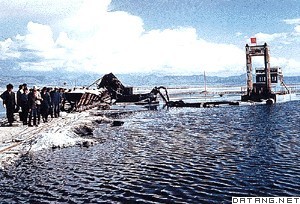
| 柴达木盆地 位于中国青海省西北部。东西长800千米,南北宽350千米。面积约20万平方千米。海拔约2600~3000米,是中国海拔最高的盆地。为高原型盆地。盆地西高东低,西宽东窄。四周高山环绕,南面是昆仑山脉,北面是祁连山脉,西北是阿尔金山脉,东为日月山,为封闭的内陆盆地。属干旱大陆性气候。气温特低,利于地下冻土层的发育。夏日消融,高原雪山来水,洪流泛滥,沼泽面积广。降水稀少、风力强劲,风沙地貌广泛发育。水系稀疏,河流短小,多达40条,以高山冰雪融水补给为主。植被稀疏,以超旱生及旱生灌木和半灌木为主,适于骆驼放牧。地形结构从边缘至中心,依次为戈壁、丘陵、平原、湖泊。四周山前平原戈壁带(即石质荒漠)广阔,宽达20千米以上,坡度5°~8°,间有零星沙漠分布,多属移动沙丘,一般高5~10米,最高50米,是复合沙丘链。东部为大片盐湖,蒙古语柴达木即盐泽之意,主要有察尔汗盐湖、茶卡盐湖、柯柯盐湖、昆特依盐湖等,盐层平均厚4~8米,最厚60米,蕴藏有丰富的盐类和其他化学元素。主要有盐、硼、钾、镁、锂、铷、溴、碘、锶、铯、石膏、芒硝、天然碱等,食盐达600多亿吨。盆地铅、锌、铬、锰等金属及煤炭、石油、石棉等资源丰富。东部和东南部河湖冲积平原,宜农地面积大,农业高产,畜牧业发达。有聚宝盆之称。
|
说明:补充资料仅用于学习参考,请勿用于其它任何用途。
参考词条
