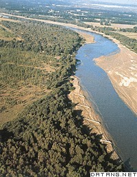
1) Bayannao'er City Linhe Area


巴彦淖尔市临河地区
2) Bayannur


巴彦淖尔市
1.
The Investigation of Fishier Resources for Middle and Small Lakes of The Farming System in Bayannur;
巴彦淖尔市农垦系统中小湖泊渔业资源调查
2.
This article,unlike its predecessors which focus on the subordination of bayannur through history, discusses its organizational system over the years and its major contributions in different times.
文章跳出以往讲历史沿革多言归属的轨辙,着力讨论巴彦淖尔市境内曾有的建置,对各个时期巴彦淖尔市境内人民的主要建树进行了宏观表述。
3.
Since the execution of“eleventh five-year plan of Bayannur”, and especially under the push of government policies of attracting investment, the local tomato industrialization has been developing dramatically.
巴彦淖尔市“十一五”规划实施以来,在政府招商引资政策的推动下,巴彦淖尔市番茄产业化经营获得迅速发展,目前已成为促进地方农业经济发展、提高农民收入、繁荣农村社会的重要力量。
3) Bayannur


巴彦淖尔
1.
A Study on the Development of Eco-agriculture in Bayannur;


巴彦淖尔生态农业发展研究
2.
The Introduction Experiment on Euonymus bungeanus in Bayannur city in Inner Mongolia


丝棉木在内蒙古巴彦淖尔市套区的引种试验
3.
This paper,based on field observation and data review,classifies the geological relics resources in Bayannur geopark,summarizes the human scenical resources,clarifies the major tourism resource,and presents some approaches to geological relics protection and tourism development.
在野外综合地质考察和全面收集资料的基础上,本文对巴彦淖尔地质公园内地质遗迹资源进行系统的分类和论述,概括了公园内的人文景观资源,明确了公园的主体旅游资源。
4) Ba Meng district


巴彦淖尔盟
1.
An analysis on the prospect of Lycium bararum breeded in Ba Meng district;


巴彦淖尔盟培育枸杞的发展前景初探
5) Mogolia


巴彦洪格尔
6) Habahe region


哈巴河地区
补充资料:巴彦淖尔盟
| 巴彦淖尔盟 位于中国内蒙古自治区西部。巴彦淖尔系蒙古语,意为丰饶的湖泊,因境内有著名淡水湖乌梁素海及众多湖泊而得名。简称巴盟。东与包头市、乌兰察布盟接壤,南隔黄河与伊克昭盟相望,西连阿拉善盟,北与蒙古国交界,国境线长368.89千米,面积6.44万平方千米 ,1990年人口 156.26万,其中蒙古族6.56万,其他少数民族2.35万。辖临河市、五原县、磴口县、杭锦后旗、 乌拉特中旗、乌拉特前旗、乌拉特后旗4旗 、2县、1市,盟人民政府驻临河市。汉时分属朔方郡、五原郡。唐时属丰州辖境,元时属中书省直辖。明中叶以后,皆入蒙古。清末属归绥道五原厅辖境,隶山西节制,民国时期属绥远省辖,1956 年设巴彦淖尔盟 。1958年河套行政区并入。1969年阿拉善左旗、阿拉善右旗和额济纳旗划出。
|
说明:补充资料仅用于学习参考,请勿用于其它任何用途。
参考词条
