1) Changjiang Zhongxiayou Pingyuan

长江中下游平原
2) Yangtze Delta Plain
长江下游平原区
1.
Landscape structure,management and soil organic carbon in the densely populated village landscapes of China s Yangtze Delta Plain;
长江下游平原区乡村景观的结构、管理和土壤有机碳研究
3) Lower Valley of the Yangtze River
长江下游平原
1.
Characteristics of Climate Change during Wheat Growing Season and the Orientation to Develop Wheat in the Lower Valley of the Yangtze River;
长江下游平原小麦生长季气候变化特点及小麦发展方向
4) middle and lower reaches of the Yangtze River
长江中下游
1.
Fluvial process forecasting for the middle and lower reaches of the Yangtze River;
长江中下游的河床纵剖面演变分析及预测
2.
Several issues on sand excavation planning modification in mainstream channels of the middle and lower reaches of the Yangtze River;
长江中下游干流河道采砂规划修编中几个问题的探讨
3.
Spatial and temporal distribution and climatic characteristics of flood in middle and lower reaches of the Yangtze River in 1849;
1849年长江中下游大水灾的时空分布及天气气候特征
5) the middle and lower reaches of the Yangtze River
长江中下游
1.
Study on ecological flow in the middle and lower reaches of the Yangtze River;
长江中下游河道生态流量研究
2.
The working principle of the acoustic doppler profiler and its applications in the middle and lower reaches of the Yangtze River;
声学多普勒流速剖面仪原理及其在长江中下游的应用
3.
Magnetic properties of sediments in the middle and lower reaches of the Yangtze River;
长江中下游河流沉积物磁性特征初探
6) Middle and lower reaches of the Changjiang River
长江中下游
1.
This paper reports the analytical results of major chemical components of 94 loess samples from the Xiashu loess profile in the middle and lower reaches of the Changjiang River, the major component contents and the weathering intensity of Xiashu loess were compared with those of Luochuan loess from Northwest China.
根据长江中下游三个下蜀土剖面94个样品主要组分元素化学成分的分析结果,结合西北洛川黄土数据资料进行了下蜀土剖面主要元素成分含量和风化程度的分析对比。
2.
In the construction of big graffic bridges across the middle and lower reaches of the Changjiang River,complicated engineering geological problems have occurred,such as fault,soft interlayer,extremesoft rock,karst cave and so on.
在长江中下游跨江特大桥建设中遇到了地震与断裂构造、软弱层带、极软岩、岩溶等复杂的工程地质问题。
补充资料:长江中下游平原
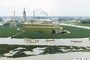
| 长江中下游平原 中国长江三峡以东的中下游沿岸带状平原。北界淮阳丘陵和黄淮平原,南界江南丘陵及浙闽丘陵。由长江及其支流冲积而成。面积约20多万平方千米。地势低平,海拔大多50米左右。中游平原包括湖北江汉平原、湖南洞庭湖平原(合称两湖平原)、江西鄱阳湖平原;下游平原包括安徽长江沿岸平原和巢湖平原(皖中平原)以及江苏、浙江、上海间的长江三角洲。气候大部分属北亚热带,小部分属中亚热带北缘。年均温14~18℃,最冷月均温0~5.5℃,绝对最低气温-10~-20℃,最热月均温27~28℃,无霜期210~270天。农业一年二熟或三熟,年降水量1000~1400毫米,集中于春、夏两季。地带性土壤仅见于低丘缓冈,主要是黄棕壤或黄褐土。南缘为红壤,平原大部为水稻土。农业发达,土地垦殖指数高(上海62.1%,江苏45.6%),是重要的粮、棉、油生产基地。盛产稻米、小麦、棉花、油菜、桑蚕、苎麻、黄麻等。河汊纵横交错,湖荡星罗棋布,湖泊面积2万平方千米,相当于平原面积10%。两湖平原上,较大的湖泊有1300多个,包括小湖泊,共计1万多个,面积1.2万多平方千米,占两湖平原面积的20%以上,是中国湖泊最多的地方。有鄱阳湖、洞庭湖、太湖、洪泽湖、巢湖等大淡水湖,与长江相通,具有调节水量,削减洪峰的天然水库作用,产鱼、虾、蟹、莲、菱、苇,还有中华鲟、扬子鳄、白鱀豚等世界珍品,水产在中国占重要地位,素称鱼米之乡。是经济最发达的地区之一,有上海市、南京市、武汉市、南昌市、苏州市、无锡市、常州市、南通市、芜湖市、长沙市等城市。主要工业有钢铁、机械、电力、纺织和化学等,是重要的工业基地。平原居中国南北和东西交通网的枢纽地带,水陆交通都很发达。长江贯穿中部,成为一条东西向的水运大动脉,加上其无数支流,构成一庞大水道网。
|
说明:补充资料仅用于学习参考,请勿用于其它任何用途。
参考词条