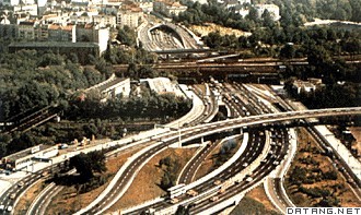
1) national highway


国有高速公路
2) existing expressway


既有高速公路
1.
The article analyzes the characteristics of the existing expressway longitudinal section alignment,discusses the fitting mathematical model and method of the longitudinal section alignment, puts forward the fitting standard,and utilizes ObjectARX platform and VC language to prepare the application program and applies its in the practical projects.
该文分析了既有高速公路纵断面线形的特点,对纵断面线形拟合的数学模型及方法进行了探讨,提出了拟合标准;利用ObjectARX平台与VC语言编制了应用程序,并在实际工程中得到应用。
4) national expressway net


国家高速公路网
1.
Superposition Images on Highway Engineering Geologic Disasters and National Expressway Net Based on MAPGIS;
基于MAPGIS的国家高速公路网与公路工程地质灾害叠加图的研究与应用
2.
Based on the investigation data of national geologic disaster survey for counties and cities from 1999 to 2005,the inquiry system of superposition images on engineering geologic disasters and national expressway net(7918net),as an example,is established with the scale of 1∶18000000 by MAPGIS 6.
5软件,以国家高速公路网(7918网)为例,建立1∶1800万的7918网与公路工程地质灾害叠加图查询系统,从而提出路线层面和区域层面的两种应用模式,是对公路自然区划标准中二级区划的有益补充。
5) Autobahn
[英]['ɔ:təubɑ:n] [美]['ɔtə,bɑn]


(德国) 高速公路
补充资料:德国高速公路
| 德国高速公路 Autobahn 德国是世界上最早修建高速公路的国家。1932年试建了科隆至波恩的高速公路,设4个车道。此后开始大规模规划、设计、建设高速公路。截至1939年第二次世界大战开始,共建高速公路3440千米,形成以柏林为中心、向四周辐射的高速公路网。第二次世界大战后,前联邦德国继续整修扩建高速公路,至1970年高速公路总里程达到4460千米,1985 年又增至8000余千米,基本建成全国高速公路网。
德国高速公路有统一的技术标准。4 车道高速公路的路基宽29米,每一车道宽3.75 米,中间分隔带宽4.0米,两边各设3米宽的路肩紧急停车道。设计车速为 100~120千米/小时,无高速限制,最低车速限制为60千米/小时。高速公路有混凝土路面和沥青路面两种,分别占27%和73%。高速公路沿线有齐全的服务、安全、通信、监察等设施。 |
说明:补充资料仅用于学习参考,请勿用于其它任何用途。
参考词条
