1) sedimentation basin


沉积盆地;沉淀池
2) setting basin


沉降盆地;沉淀池
3) sedimentary basins


沉积盆地
1.
Tectono-thermal modeling of sedimentary basins:review and outlook;


沉积盆地构造热演化研究进展:回顾与展望
2.
With introduction and discussion of the dynamics of sedimentary basins and basin reservoir(ore) forming systems to be a main line,this paper generalizes and summarizes author's thoughts and viewpoints in this area.
以沉积盆地动力学与盆地成藏(矿)系统为主线,梳理和归纳了笔者在此方面理论研究的部分认识和观点。
3.
As an important means of geofluids research,the fluid inclusion study has played an significant role in the study on the formation environment of petroleum reservoir,the relationship among the coexisted organic & inorganic mineral deposits in sedimentary basins.
流体包裹体作为地质流体研究的重要手段,在沉积盆地油气成藏条件分析和有机/无机矿产共存、共生关系研究中起着不可替代的作用。
4) Sedimentary basin


沉积盆地
1.
Analysis of the key control factors of the formation of lithological stratigraphic traps in sedimentary basins;
沉积盆地岩性地层圈闭成藏主控因素分析
2.
Prospectivity for oil and gas in sedimentary basins superposed on arc-like folded belts in Mongolia;
蒙古弧形褶皱带上叠沉积盆地油气远景
3.
Genetic mechanism of non-hydrocarbon gas in China sedimentary basin;


中国沉积盆地非烃气成因机制研究
6) deposited chamber,sedimentary tank


沉积池(地)
补充资料:柴达木盆地
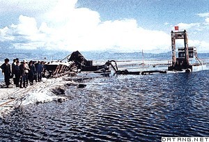
| 柴达木盆地 位于中国青海省西北部。东西长800千米,南北宽350千米。面积约20万平方千米。海拔约2600~3000米,是中国海拔最高的盆地。为高原型盆地。盆地西高东低,西宽东窄。四周高山环绕,南面是昆仑山脉,北面是祁连山脉,西北是阿尔金山脉,东为日月山,为封闭的内陆盆地。属干旱大陆性气候。气温特低,利于地下冻土层的发育。夏日消融,高原雪山来水,洪流泛滥,沼泽面积广。降水稀少、风力强劲,风沙地貌广泛发育。水系稀疏,河流短小,多达40条,以高山冰雪融水补给为主。植被稀疏,以超旱生及旱生灌木和半灌木为主,适于骆驼放牧。地形结构从边缘至中心,依次为戈壁、丘陵、平原、湖泊。四周山前平原戈壁带(即石质荒漠)广阔,宽达20千米以上,坡度5°~8°,间有零星沙漠分布,多属移动沙丘,一般高5~10米,最高50米,是复合沙丘链。东部为大片盐湖,蒙古语柴达木即盐泽之意,主要有察尔汗盐湖、茶卡盐湖、柯柯盐湖、昆特依盐湖等,盐层平均厚4~8米,最厚60米,蕴藏有丰富的盐类和其他化学元素。主要有盐、硼、钾、镁、锂、铷、溴、碘、锶、铯、石膏、芒硝、天然碱等,食盐达600多亿吨。盆地铅、锌、铬、锰等金属及煤炭、石油、石棉等资源丰富。东部和东南部河湖冲积平原,宜农地面积大,农业高产,畜牧业发达。有聚宝盆之称。
|
说明:补充资料仅用于学习参考,请勿用于其它任何用途。
参考词条
