1) plot sketch

标绘示意图
2) land-use mapping
绘制土地利用示意图 LUM
3) site mapping
绘制生境示意图 SM
4) hazard mapping
绘制危险地区示意图 HM
5) coordinate sketch-map
环境坐标示意图
1.
In this article ,we introduce how to use the technology of screen capture to draw coordinate sketch-map for the site of weather modification.
介绍利用屏幕截取技术制作人降作业炮点四周环境坐标示意图的方法。
6) map
n.地图,图 vt.在地图上标示出,绘制地图
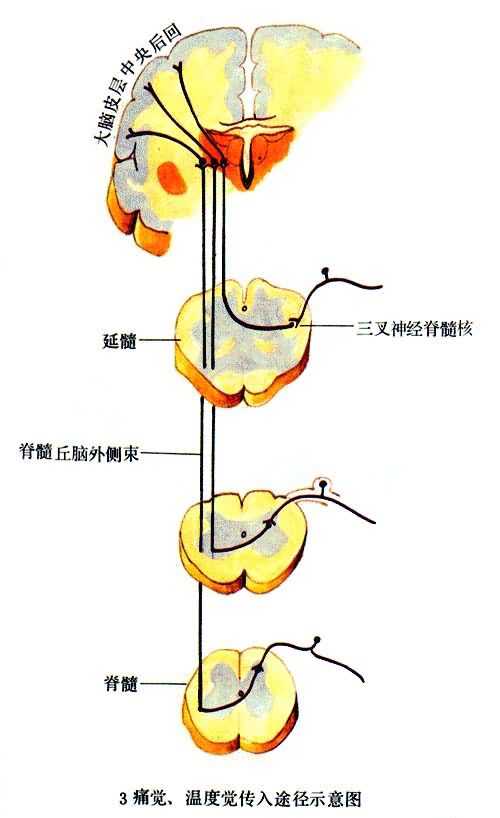
补充资料:感觉传导途径 3痛觉、温度觉传入途径示意图
李瑞端绘
[图]
说明:补充资料仅用于学习参考,请勿用于其它任何用途。
参考词条