1) error of tilt


倾角误差
2) wobble error


倾角回转误差
1.
A series of coordinate systems is set up on a perpendicular axis,and by the attitude relations among coordinate systems,the equations of readouts of the level instrument and the autocollimator are deduced when they areused to measure the wobble error of the axis system.
在某回转轴系上建立了一系列坐标系 ,通过坐标系之间的姿态关系分别推导了用水平仪测试法和自准直光管测试法测试主轴轴系倾角回转误差时水平仪和光管的读数表达式。
3) Obliquity error movement


倾角误差运动
4) equivalent tilt angle error


等效倾角误差
5) Error of grating groove angle


光栅刻槽倾角误差
6) tilt error


倾斜误差
1.
In this paper, according to the characteristics of central projection, aerial photographs were analyzed to discuss displacement of images under tilt conditin or caused by ground undulation, based on which the principles of tilt error and projection error were summarized.
根据中心投影的特性,论述了像片在倾斜条件下所引起的像点位移和像片因地面起伏而引起的像点位移,在对其进行分析的基础上总结出倾斜误差和投影误差的规律,从而说明了不能把像片当作地形图使用。
补充资料:磁倾角
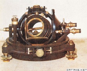
| 磁倾角 geomagnetic inclination 地球表面任一点的地磁场总强度的矢量方向与水平面的夹角。将一个具有水平轴的可旋转磁针制做得内部质量完全均匀对称,使其在磁屏蔽空间中自然地保持水平。观测时使其水平轴与当地磁子午面垂直,这时磁针指北极N所指的方向即为地磁场总强度的矢量方向,它与水平面的夹角即为当地的磁倾角。这种磁针称为磁倾针。规定磁倾针的指北极N向下倾为正。一般结果是,北半球的磁倾角为正,南半球的磁倾角为负。将磁倾角为零的地点连结起来,此线称为磁倾赤道,与地球赤道比较接近。
|
说明:补充资料仅用于学习参考,请勿用于其它任何用途。
参考词条
