1) bottom view

下视图
2) bottom view
下[底]视图
3) forward-looking aerial images
前下视航拍图像
1.
Automatic detection of airfield runways in forward-looking aerial images with low visibility;
低能见度前下视航拍图像中机场跑道的自动检测
4) underwater TV image
水下电视图像
6) under-hood view
机罩下外视图
补充资料:航拍
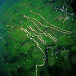
航拍
航拍(aerial photography)是指从空中拍摄地球地貌,获得俯视图。航拍图能够清晰的表现地理形态,因此除了作为摄影艺术的一环之外,也被运用于军事、交通建设、水利工程、生态研究、城市规划等方面。
说明:补充资料仅用于学习参考,请勿用于其它任何用途。