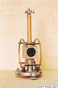
1) deviation of the vertical


垂线偏角
2) angles drift off vertical line


指针偏离垂直线的角度
3) plumb line deflection


垂线偏差
1.
However, it is one of the topics worthy of study that how the results of GPS survey that is based on the normal line can be converted to be compatible with the traverse survey inside tunnels that is based on the plumb line, so as to minimize the influence of the plumb line deflection on the transverse break-through accuracy of tunnels.
但是,如何将以法线为准的地表GPS成果改换到与以垂线为准的洞内导线测量相符合,从而解决好垂线偏差对隧道贯通精度的影响,是一个值得探讨的问题。
2.
WT5BZ]In this paper, the plumb line deflection varied with time (PLV) are calculated with the Vening Meinesz formula for Xiaguan and Beijing point based on the 28th and 39th campaigns of gravimetry at the local gravity networks in the Western Yunnan Earthquake Prediction Experiment Area and the North China.
根据滇西和华北地震重力监测网 2 8期和 39期重力测量资料 ,利用 Vening- Meinesz公式 ,分别计算了下关和北京两地垂线偏差的时间变化 。
4) plumb line deviation


垂线偏差
1.
During the submarine-launching missile test,the plumb line deviation of launch point is very difficult to measure exactly.
在潜射导弹试验时,发射坐标系原点的垂线偏差很难准确测量,虽然垂线偏差只有几个角秒,但是对远程导弹的定位结果影响却很大。
2.
In order to analyze the influence of plumb line deviation of launching point on target solution result,the formula for point-by-point multi-station crossing was deduced by the least squares estimate aiming at continuous wave radar measurement system.
为分析原点垂线偏差对目标解算结果的影响,针对连续波雷达测量系统,采用最小二乘法推导了多站交会逐点解算公式。
5) deflection of the vertical


垂线偏差
1.
Influence of meridian constringent angle and deflection of the vertical on result of gyro azimuth measurement;
子午线收敛角和垂线偏差对陀螺方位角的影响
2.
The author of this treatise puts forward the theory and method of determining the height anomaly and evaluating GPS network normal height by combining GPS level with zenith distance observation (calculating the deflection of the vertical).
本文提出了在山区测区条件下,利用GPS水准结合天顶距观测(计算垂线偏差)直接确定高程异常,进而求解GPS网正常高的理论与方法,具有良好的技术与实践价值。
6) vertical deflection


垂线偏差
1.
Study on ocean vertical deflection of ENVISAT satellite altimetry along-track geoid gradient;
ENVISAT测高卫星沿轨大地水准面梯度的海洋垂线偏差法研究
2.
First,GPS leveling is used to fit local quasi geoid of both sides of obstacle and then vertical deflections are determined, which belong to WGS-84.
鉴于障碍物两侧的高程基准不一致,采用常规的GPS水准数值拟合方法,无法实现跨障碍高程传递,提出了一种天文GPS水准方法,即采用常规GPS水准方法分别拟合障碍物两侧的似大地水准面形状,分别求得相对于WGS 84的地面垂线偏差;由于两侧所求垂线偏差属于同一系统,因此,可根据天文水准原理,进一步计算出跨障碍的高程异常差;再由GPS所测大地高差,可获得跨障碍的正常高差。
3.
In this paper,a new method based on vertical deflection is used to solve the question,in which GPS leveling is used to determine surface deflections on each side of obstacle separately, afterwards surface deflections used to compute height anomaly difference between both sides of a river.
新方法从垂线偏差入手 ,首先采用 GPS水准分别测定海峡两侧的地面垂线偏差 ,再由所求垂线偏差计算跨海峡的高程异常差。
补充资料:磁偏角
| 磁偏角 geomagnetic declination 地球表面任一点的磁子午圈同地理子午圈的夹角。因指南针、磁罗盘是测定磁偏角最简单的装置,所以磁偏角的发现和测定的历史也很早。1702年,英国E.哈雷发表了第一幅大西洋磁偏角等值线图。根据规定,磁针指北极N向东偏则磁偏角为正,向西偏则磁偏角为负。
|
说明:补充资料仅用于学习参考,请勿用于其它任何用途。
参考词条
