1) inosculating
[英][in'ɔskjuleit] [美][ɪn'ɑskjə,let]


地物模型与地貌模型融合
2) integration of land-form model with land-eature model


地物地貌模型集成
3) geometric objects


地物模型
1.
An algorithm to implement surface subdivision based on texture feature curves and elevation data was put forward to build multi-resolution geometric objects.
结合纹理特征曲线和高程数据,提出了一种曲面细分的算法来构建多分辨率地物模型。
2.
Based on the relation of geometric objects and terrain triangular irregular network, the various geometric objects are divided into two parts in this paper.
根据地物模型与地形三角网关系 ,将种类繁多地物模型划分为两大类。
4) ground feature model


地物模型
1.
In the course real-time rendering of large scale terrain,if the ground feature model and the terrain model cannot match with each other,cannot feel the verisimilitude of the virtual terrain environment.
在大规模地形实时可视化中,地物模型能否与地形模型无缝叠加将直接关系到视觉感受的逼真程度。
2.
So, if the ground feature model and the terrain model cannot match with each other, we could not feel the verisimilitude of the virtual terrain environment and the precision of hitting target will be debased.
在这种情况下地物模型能否与地形模型相匹配(即虚拟场景中的地物既不悬于地表之上也不陷入地表之下)将直接关系到视觉感受的逼真程度,以及在虚拟场景中对目标实施打击的精确程度。
5) model of denudation


剥蚀地貌模型
6) D geomorphic model


四维地貌模型
1.
The 4 D geomorphic model, which comes out of adding the time dimension on the 3 D model, can simulate the time development of the geomorphic landscape.
在三维模型基础上增加了时间维的四维地貌模型 ,能够模拟地貌景观随时间的演变。
补充资料:AutoCad 教你绘制三爪卡盘模型,借用四视图来建模型
小弟写教程纯粹表达的是建模思路,供初学者参考.任何物体的建摸都需要思路,只有思路多,模型也就水到渠成.ok废话就不说了.建议使用1024X768分辨率
开始
先看下最终效果

第一步,如图所示将窗口分为四个视图

第二步,依次选择每个窗口,在分别输入各自己的视图

第三步,建立ucs重新建立世界坐标体系,捕捉三点来确定各自的ucs如图

第四步,初步大致建立基本模型.可以在主视图建立两个不同的圆,在用ext拉升,在用差集运算.如图:

第五步:关键一步,在此的我思路是.先画出卡爪的基本投影,在把他进行面域,在进行拉升高度分别是10,20,30曾t形状.如图:

第六步:画出螺栓的初步形状.如图

第七步:利用ext拉升圆,在拉升内六边形.注意拉升六边行时方向与拉升圆的方向是相反的.
之后在利用差集运算


第八步:将所得内螺栓模型分别复制到卡爪上,在利用三个视图调到与卡爪的中心对称.效果如图红色的是螺栓,最后是差集

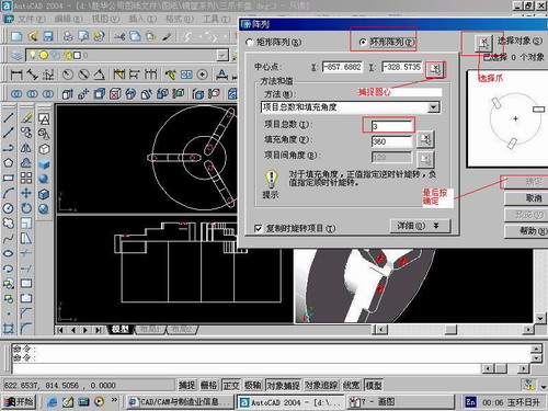
第九步:阵列

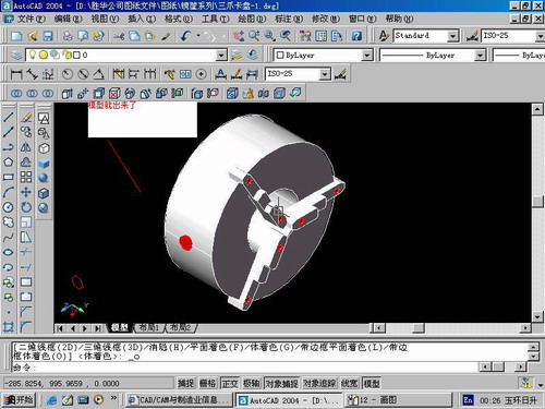
第10步.模型就完成了

来一张利用矢量处理的图片

说明:补充资料仅用于学习参考,请勿用于其它任何用途。
参考词条