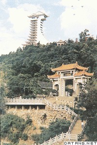
2) Jialing River Basin


嘉陵江流域
1.
A GIS-Based Study of the Pollution Load of Adsorbed Nitrogen and Phosphorus in Jialing River Basin,P. R. China;
GIS的嘉陵江流域吸附态氮磷污染负荷研究
2.
Research on the Culture Characteristic of Human Settlements in Jialing River Basin;


嘉陵江流域人居空间文化特质研究
3.
Forest Community Structural Features of Jincheng Mountain in Nanchong Region in Jialing River Basin;
嘉陵江流域南充金城山森林群落结构特征分析
3) Jialingjiang River Basin


嘉陵江流域
1.
Research on the On-line Real-time Flood Forecasting for the 3 Rivers in Jialingjiang River Basin;
嘉陵江流域三江汇流洪水联机实时预报研究
2.
Started with some instances about the Jialingjiang River basin and Lizikou little basin, combined the actuality of the study of the soil erosion and sediment yield models of the Yangtse River,the soil erosion and sediment yield models of small watershed in Lizikou are discussed.
到目前为止,国内外对土壤侵蚀产沙模型已经进行了大量的研究,建立了大量的土壤侵蚀产沙模型,从嘉陵江流域、李子口小流域的基本情况(尤其是水土流失现状)入手,结合长江流域侵蚀产沙模型研究情况,初步探讨了李子口小流域侵蚀产沙模型。
4) Jlaling River


嘉陵江水域
5) Jincheng Mountain in Jialing River basin


嘉陵江流域金城山
1.
in Jincheng Mountain in Jialing River basin.


[目的]分析嘉陵江流域金城山草本层淫羊藿植物群落的稳定性。
6) mainstream of the Jialing River


嘉陵江干流
1.
Then, the standards for determination of the grade of peak discharges in the mainstream of the Jialing River and for qualitative classification in the medium-and long-term flood prediction were discussed.
根据重现期将洪水划分为12个等级,根据年最大流量距平值将洪水中长期定性预报分成7个等级,同时对嘉陵江流域干流洪水的洪峰流量等级标准和中长期预报定性分级标准进行了探讨,分析了嘉陵江干流1981年7月发生的洪水等级。
补充资料:广元市
| 广元市 位于四川省北部。辖剑阁、苍溪、旺苍、青川4县。1990年人口283.05万,有汉、回两民族,以汉族为主。西周为蜀国领地。东晋析晋寿东境建兴安县。隋改绵谷县,设利州为义城郡。唐升都督府。元改利州为广元府。明初仍为广元府,继改为州,再降为县。1953年更名广元专署,1985年2月建市。地势西北高东南低。为亚热带湿润季风区,年均温16.1℃,年降水量1081毫米。有矿藏30多种。广元市是四川省电子工业的重点基地之一。森林覆盖率26%,是四川省油桐、生漆、核桃、木耳、杜仲等主产区之一。有野生大熊猫、小熊猫、金丝猴、华南虎等。名胜古迹有千佛岩摩崖造像等。
|
说明:补充资料仅用于学习参考,请勿用于其它任何用途。
参考词条
