1) Eastern Hainan Island


海南岛东部海域
1.
The monthly variations in Sr/Ca ratio of the Porites coral from Eastern Hainan Island have been studied using the ICP-AES technique.
文章采用全谱直读等离子体原子发射光谱(ICP-AES)的方法测定了1986~1996年海南岛东部海域滨珊瑚的Sr/Ca比值,建立了该海域月分辨率的Sr/Ca海水表面温度计方程:SST(℃)=170-16[Sr/Ca](mmol/mol),n=133,r=0。
2) Sea waters south and east of Taiwan Island


台湾岛东部和南部海域
3) south East China Sea


东海南部海域
1.
Species composition and characteristics of crab distribution in south East China Sea;


东海南部海域蟹类种类组成及分布特征
4) the eastern area of the South Yellow Sea


南黄海东部海域
1.
The present paper intends to introduce a one-dimensional physical-biological model developed by the author in hoping to enhance the thorough understanding on the plankton ecosystem in the Yellow Sea,that is,the annual cycle of its vertical structure in the eastern area of the South Yellow Sea.
利用海洋生态系统动力学垂直一维物理-生物耦合模式模拟研究了南黄海东部海域浮游生态系统要素垂直分布的季节变化。
5) Northeastern Hainan Island


海南岛东北部
6) the south ocean area of Taiwan Island


台湾岛南部海域
补充资料:海南岛
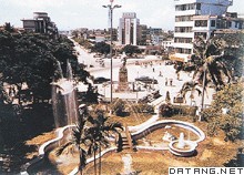
| 海南岛 中国第二大岛。海南省的陆域主体。位于中国南海西北部。古称珠崖、儋耳或琼台。最北端为海南角,北纬20°10′;最南端为锦母角,北纬18°10′;最东端为铜鼓角,东经111°02′;最西端为鱼鳞角,东经108°37′。长约300千米,宽约180千米。面积3.36万平方千米。海南岛琼海市容海南岛地势中央高、四周低,呈环状结构。以五指山为中心,向四周依次降为山地、丘陵、台地和滨海平原。水系多呈放射状,河流水位随降水量年内分配不匀而暴涨暴落,水力资源蕴藏量近100万千瓦。具有热带季风气候特点,光能充足,1月均温17~20℃,雨量充沛,东湿西干。植被有热带雨林和季雨林、热带草原类型。水稻年可三季连作。为中国发展热带作物的重要基地,东南部栽培有橡胶、油棕、椰子、可可、胡椒、咖啡等;西部有剑麻、番麻和海岛棉等。沿海渔、盐业发达。
|
说明:补充资料仅用于学习参考,请勿用于其它任何用途。
参考词条
