1) ecological investigating

海南岛杂草稻
2) Islands in Hainan
海南海岛
3) Weedy rice
杂草稻
1.
Stress resistance and genetic characteristics of weedy rice in the Northeast area of China;
东北地区杂草稻的抗逆性及遗传特性
2.
Origin and Control Measurement of Weedy Rice in Liaoning;
辽宁省杂草稻的发生及其控制措施
3.
Cluster analysis of weedy rice based on agronomic traits;
杂草稻种质资源农艺性状的主成分及聚类分析
5) Hainan Island
海南岛
1.
Characteristics of Heavy Metals Distribution in Agricultural Soils of Hainan Island and Its Environment Significances;
海南岛农用地土壤重金属元素的空间分布特征及其环境意义
2.
Study on Effects of Nutrient Loading on Enhalus acoroides in the Xincun Bay,Hainan Island;
海南岛新村湾营养负荷对海菖蒲的影响研究
3.
GIS-based Ecological Suitability Evaluation of Industrial Land Use——A Case Study of Hainan Island;
海南岛土地生态适宜性评价
6) Hainan Province
海南岛
1.
A New Record of Theloderma kwangsiensis in Hainan Province,China;
海南岛蛙类新纪录——广西棱皮树蛙
2.
Based on the statistical data from 1970 to 2004, and by using statistical analysis methods, we analyzed the dynamic changing relation between the cultivated lands and the growth of population and economic development in Hainan province in recent 35 years.
采用1970—2004年的统计资料,用统计方法,研究了近35a来海南岛耕地变化过程与人口增长、经济发展之间动态变化关系,建立了耕地资源减少量与人口总数、固定资产投资总额、人均GDP和城市化水平间的三个曲线相关模型。
补充资料:海南岛
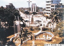
| 海南岛 中国第二大岛。海南省的陆域主体。位于中国南海西北部。古称珠崖、儋耳或琼台。最北端为海南角,北纬20°10′;最南端为锦母角,北纬18°10′;最东端为铜鼓角,东经111°02′;最西端为鱼鳞角,东经108°37′。长约300千米,宽约180千米。面积3.36万平方千米。海南岛琼海市容海南岛地势中央高、四周低,呈环状结构。以五指山为中心,向四周依次降为山地、丘陵、台地和滨海平原。水系多呈放射状,河流水位随降水量年内分配不匀而暴涨暴落,水力资源蕴藏量近100万千瓦。具有热带季风气候特点,光能充足,1月均温17~20℃,雨量充沛,东湿西干。植被有热带雨林和季雨林、热带草原类型。水稻年可三季连作。为中国发展热带作物的重要基地,东南部栽培有橡胶、油棕、椰子、可可、胡椒、咖啡等;西部有剑麻、番麻和海岛棉等。沿海渔、盐业发达。
|
说明:补充资料仅用于学习参考,请勿用于其它任何用途。
参考词条