2) ridge
[英][rɪdʒ] [美][rɪdʒ]

山脊
1.
Study on the simplified model of wind farm in the ridge;
山脊地形上的风场简化模型
2.
Further,give the mathematical definition of basic lardform shape as the slope,mountain,ridge,depression,groge,saddle,etc.
继而给出了如斜坡、山、山脊、凹地、谷地、鞍部等基本地貌形态的数学定义。
3) A natural ridge;a hogback.
马背岭一种天然的山脊;陡峻的嵴
4) ridge line
山脊线
1.
Derivation of valley line and ridge line by segmental cubic polynomials;
利用分段三次多项式提取山谷线和山脊线
2.
A ridge line extraction algorithm is proposed based on DEM according to the characteristic of the terrain,firstly,the algorithm fills depressions and smoothes the terrain efficiently,then extracts the ridge line and thins it,lastly,the main ridge line is extracted to meet the requirement of the occlusion culling.
针对大规模复杂地形的特点,提出了一种有效的基于规则网格的地形主山脊线特征提取算法。
3.
The usual method for extracting ridge line and valley line is based on geometric and physical character which is difficult to use the information hiding in the digital data.
针对当前山脊线和山谷线的提取都是从其几何特征或物理特征的单一方面进行研究和设计,不能够利用隐含在数字化资料中的山脊线和山谷线的有效信息的弊端;本文利用几何分析方法Douglas-Peuker提取山脊线和山谷线的特征点,并结合提取区域内地形概略的分水线和汇水线,用概略的分水线和汇水线对特征点进行识别、归类、顺序提取各条山脊线和山谷线,把山脊线的几何特性与物理特性结合起来,克服了各自的弊端。
5) ridge
[英][rɪdʒ] [美][rɪdʒ]
山脊线
1.
Automatic extraction for ridge and valley by vertical sectional method;
垂直剖面法自动提取山脊线和山谷线
2.
Extraction of ridge and valley from DEM based on conjugate terrain;
基于共轭地表曲面的山脊线和山谷线提取方法的研究
3.
The authors put forwards a new method which select the terrain profile perpendicular to falling line (opposite direction of gradient) to determine the candidate points on ridge and valley.
提出了一种基于地形梯度方向的山脊线和山谷线的提取方法,该方法从理论上进一步完善了地形高程断面极值法。
6) Hongjishan
红脊山
1.
Characteristics and significance of the metamorphic minerals glaucophane-lawsonite assemblage in the Hongjishan area, north-central Qiangtang, northern Tibet, China.;
藏北羌塘中北部红脊山地区蓝闪石+硬柱石变质矿物组合的特征及其意义
补充资料:天脊龙门
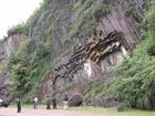
天脊龙门
天脊龙门(原名龙门峡谷)是国家级森林公园、省级风景名胜区、国家aa级旅游区——紫薇山国家森林公园的主景区之一,属衢南仙霞岭山系的一部分。景区开发面积14平方公里,是观光旅游与休闲度假与一体的风景旅游区。位于衢州衢江区坑口乡龙门村,距市区34公里。属火山岩峡谷地貌,为一大断裂构造。区内山岭走向复杂,范围广阔,山势挺拔、陡峭,流水切割山体,山体坡度均在40度以上,从龙门到水门尖为一条长达25华里的大峡谷,相对高差近1000米。这里有海拔千米以上的山峰54座,沟谷深达几百米,呈典型的“v”字型谷地,由而形成了峡谷纵横、峰峦盘踞的深谷奇峰景观。景区集奇山异石、天然洞府、幽谷川流和自然园林景观于一体,聚山、林、泉、瀑、云、雾等奇观于一谷,形成了险、雄、奇、秀、幽之形胜。
峡谷的主要景点有龙门石笋、三鼎山、龙潭飞瀑 、天脊背瀑布、龙洞等。该风景区目前已开发出龙潭飞瀑、恒温24℃的龙涎圣泉、响谷回音、吊桥咏诗、青藤仙子、赤松行宫、白娘子斗法海、济公出世、龙门裂豁以及有72株古树的孔家山古树群等30多处景点。
说明:补充资料仅用于学习参考,请勿用于其它任何用途。