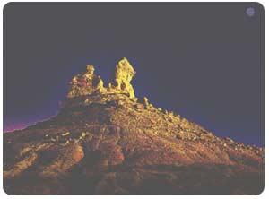
1) Qitai oasis


奇台县绿洲
1.
Study on influence factors and characters of reversal evolvement of farmland soil salinization in Qitai oasis
奇台县绿洲农田土壤盐渍化影响因素及逆向演替特征研究
2.
Choosing farmlands of different cultivated time in plain and oasis-desert ecotone in Qitai oasis,analyzes the temporal movement of soil soluble total salt,pH value,organic matter.
在奇台县绿洲中部平原区和绿洲沙漠交错带选择不同耕种时间的农田,分析其剖面土壤可溶性总盐、pH值、有机质含量随耕种时间的变化。
2) Qitai oasis


奇台绿洲
1.
Study on the Temporal and Spatial Change of Groundwater Based on Spatial Interpolation Model--Take Qitai Oasis as Example;
基于空间插值模型的绿洲地下水时空变化研究——以奇台绿洲为例
2.
Research on Spatial and Temporal Variability of Ground Water in Qitai Oasis;


奇台绿洲地下水时空变异性研究
3.
Combined with the actual situation of the Qitai oasis,This article uses the metasynthesis method which combined with both qualitative and qu.
本文结合奇台绿洲的实际情况,采用定性和定量相结合的综合集成方法,分析评价奇台绿洲人口与资源、环境、经济可持续发展的互动协调状况,并针对问题提出具体的对策措施。
3) Qitai county


奇台县
1.
Climate change in Qitai County in Xinjiang in recent 42 a


新疆奇台县近42a气候变化特征分析
2.
Effect of chemical fertilizer application on grain yield in Qitai County,Xinjiang Uygur Autonomous Region
新疆奇台县化肥施用量变化及其与粮食单产的关系
3.
In 2001 Qitai County had been approved by Chinese Forestry Bureau as standardization demonstration county of returning the grain plots to forestry and grass,since the project implementing,according to itself conditions and character,Qitai county has formulated fighting a drought,catchment,soil moisture conservation,soil preparation,soil preparation for an important prot.
新疆奇台县位于天山北麓准噶尔盆地东南缘,2001年被国家林业局确定为退耕还林还草标准化示范县,项目实施以来,奇台县根据自身的情况和特点制定了抗旱集水保墒整地、重点防护林整地、树草种选择、生态公益林配置等切实可行的林业行业标准,并通过两个重点、八种模式、四种机制的林业工程建设,使得奇台县的退耕还林工作在全疆范围内发挥了很好的示范作用。
4) Qitai County


新疆奇台县
1.
Research of Evapotranspiration in Qitai County, Xinjiang Based on MODIS Data;


基于MODIS影像的新疆奇台县区域蒸散发量的研究
5) oasis
[英][əʊ'eɪsɪs] [美][o'esɪs]


绿洲
1.
Space-time change of oasis ecological landscape information spectrum in arid areas;


干旱区绿洲生态景观信息图谱的研究与应用
2.
Study on spatial diversification of soil moisture content of oasis and oasis-desert ecotone in the middle reaches of the Heihe River;
黑河中游绿洲及绿洲—荒漠生态脆弱带土壤含水量空间分异研究
3.
A case study on the factors of oasis-desert ecosystem evolution and its non-linear relationship in Xinjiang;
绿洲—荒漠生态系统演化因素及其非线性探讨——以新疆为例
6) oases
[英][əu'eisi:z] [美][o'esiz]


绿洲
1.
Oases as Well as Their Sustainable Development and Constructions in China;


中国绿洲及其可持续发展建设
2.
Dynamics of water resources and land use in oases in middle and lower reaches of Shiyang River watershed,Northwest China;
石羊河流域中下游绿洲土地利用变化与水资源动态研究
3.
Water Resources Utilization and Negative Eco-Environment Effect at the South Edge Oases of Taklimakan Desert;
塔克拉玛干沙漠南缘水资源开发与绿洲生态环境负效应
补充资料:奇台魔鬼城

奇台魔鬼城
神秘莫测的[奇台魔鬼城]将军戈壁深处隐藏着一座神秘莫测的古老城廓。这座城的面积大约八十平方公里。每当夜间风起时,城内就会发出凄恻阴森的声音,听起来好像神话中魔鬼的叫声,所以,人们称此地为魔鬼城。
魔鬼城内有许多维妙维肖的岩石造型,比如阿拉伯的清真寺,柬埔寨的吴哥窟,西茂的布达拉宫等等。有的还像农妇晚归、壮士观天、和尚念经、八戒睡觉、黄牛耕耘、熊猫打站、鲤鲁出水、猴子守山。这些似人似物的造型,全都栩栩如生。在地质学上,魔鬼城被称为风蚀地貌或雅丹地貌。这种地貌是由三叠系的各色沉积岩、侏罗系的各色觉积岩和白垩系的各色沉积岩组成的,经过雨水的冲刷和风力的切割,天长日久就形成了这样绚丽多彩姿态万千的自然景观。
在克拉玛依市乌尔乐乡东南三公里,有一处独特的风蚀地貌,定名为风城,人们习惯称它为“魔鬼城”。
“魔鬼城”方圆约10平方公里,地面海拔350米左右。大约一亿年前的白垩纪时,这里是一个巨大的淡水湖,湖岸生长着茂密的植物,后来经过两次大的地壳变动,湖泊变成了间夹着砂岩和泥板的陆地瀚海,地学上称它为“戈壁台地”。
由于风雨剥蚀,地面形成深浅不一的沟壑,裸露的石层被狂风雕琢得奇形怪状,在起伏的山坡上,布满血红、湛蓝、洁白、橙黄的各色石子,宛如魔女遗珠,更增添了几许神秘色彩,内城地处风口,四季多风。每当大风乔来,黄沙遮天,大风在风城里激荡回旋,凄厉呼啸,如同鬼哭,“魔鬼城”因此面得名。
魔鬼城属于雅丹地貌,在大自然鬼斧神工长期作用下,形成了一个梦幻般的迷宫世界,古今中外的名山胜迹应有尽有;各种各样的造景地貌琳琅满目,惟妙惟肖,置身于魔鬼城定能使你形象思维的特长得到充分发挥。
说明:补充资料仅用于学习参考,请勿用于其它任何用途。