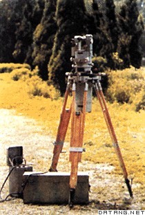
1) large scale topographic survey


大比例尺地形测量
1.
Along with the establishment of modern surveying and mapping system, which is characterized by technologies of remote sensing, global positioning system and geographical information system, the large scale topographic survey has an enormous changes in technical methods, product styles and applications.
随着以遥感(RS)、全球定位系统(GPS)和地理信息系统(GIS)为代表的现代测绘技术体系的建立,大比例尺地形测量从技术手段和产品形式及其应用上均发生了巨大的变化。
3) large scale topographic surveying and mapping


大比例尺地形测图
1.
This paper introduces the composition of Javad Legacy GPS receiver system and the characteristic of its dynamic postprocessed surveying technique, and discusses the application of the technique in large scale topographic surveying and mapping combined with the practice mining area.
介绍JavadLegacyGPS接收机系统的组成及后处理动态测量技术的特点,结合矿区大比例尺地形测图的实践,对GPS后处理技术在大比例尺地形测图中的应用进行了探讨。
4) large scale topographic map


大比例尺地形图
1.
Taking the site surveying of Nongan Sangang observation station for 1∶500 topographic map as an example,this paper discussed the technical problem on small area large scale topographic map field surveyi.
本文以农安三岗观测站站址1∶500比例尺地形图的施测为例,探讨了局部地区小范围大比例尺地形图实测的技术问题。
2.
This paper makes a study on the interactive digital generalization,and an interactive map generalization environment for large scale topographic map is then designed and realized.
在论述交互式综合环境研究的重要意义及大比例尺地形图特点的基础上 ,采用人机协同的地图缩编方式 ,将复杂的地图综合过程分解 ,合理地进行人机分工 ,设计与实现了大比例尺地形图交互式综合系统的数据库管理平台。
5) large-scale topographic map


大比例尺地形图
1.
This paper mainly discusses the classification,the structure and the design related to large-scale topographic map symbols.
地形图符号库数字地形图和地理信息系统开发的一个重要部分,本文讨论大比例尺地形图符号的分类、结构及其绘制。
2.
this pape, several kinds of simple and convenient methods of computeraided digittizing for large-scale topographic map are recommended.
本文就如何提高大比例尺地形图数字化速度,提出了几种简便而又实用的方法。
6) large scale topographical map


大比例尺地形图
1.
In this paper,a method is presented for large scale topographical map measurements in digital by aerophotogrammetric field operation with GPS RTK.
结合某开发区1∶2 000地形图航测数字化测图工程,探讨了采用GPS RTK的自由基站二步法拟合方式测量航外像控点(平高点),实施大比例尺地形图野外检测的可行性。
补充资料:地形测量
| 地形测量 topographic survey 对地球表面的地物、地形在水平面上的投影位置和高程进行测定,并按一定比例缩小,用符号和注记绘制成地形图的工作。地形图的测绘基本上采用航空摄影测量方法,利用航空像片主要在室内测图。但面积较小的或者工程建设需要的地形图,采用平板仪测量方法,在野外进行测图。
地形测量包括控制测量和碎部测量。①控制测量是测定一定数量的平面和高程控制点,为地形测图的依据。平板仪测图的控制测量通常分首级控制测量和图根控制测量。首级控制以大地控制点为基础,用三角测量或导线测量方法在整个测区内测定一些精度较高、分布均匀的控制点。图根控制测量是在首级控制下,用小三角测量、交会定点方法等加密满足测图需要的控制点。图根控制点的高程通常用三角高程测量或水准测量方法测定。②碎部测量是测绘地物地形的作业。地物特征点、地形特征点统称为碎部点。碎部点的平面位置常用极坐标法测定,碎部点的高程通常用视距测量法测定。按所用仪器不同,有平板仪测图法、经纬仪和小平板仪联合测图法、经纬仪(配合轻便展点工具)测图法等。它们的作业过程基本相同。测图前将绘图纸或聚酯薄膜固定在测图板上,在图纸上绘出坐标格网,展绘出图廓点和所有控制点,经检核确认点位正确后进行测图。测图时,用测图板上已展绘的控制点或临时测定的点作为测站,在测站上安置整平平板仪并定向,然后用望远镜照准碎部点,通过测站点的直尺边即为指向碎部点的方向线,再用视距测量方法测定测站至碎部点的水平距离和高程,按测图比例尺沿直尺边沿自测站截取相应长,即碎部点在图上的平面位置,并在点旁注记高程。这样逐站边测边绘,即可测绘出地形图。 |
说明:补充资料仅用于学习参考,请勿用于其它任何用途。
参考词条
