1) Geological dissection


地质剖分
2) texture profile analysis


质地剖面分析
1.
The effects of soy,sugar,salt on the texture characteristics of steamed pork bacon with rice powder were studied by the method of texture profile analysis.
采用质地剖面分析法(TPA,texture profile analysis)研究了酱油、白糖、食盐对粉蒸肉质构的影响,结果表明:带皮肥肉和瘦肉的硬度和耐嚼性随着酱油的增加而增加,无皮肥肉的弹性、凝聚性和回复性变化较大;白糖对带皮肥肉的硬度、弹性、回复性和瘦肉的耐嚼性影响显著;食盐对带皮肥肉的硬度和回复性、无皮肥肉的弹性和回复性影响不显著。
2.
Tissue structure and rheological properties of foot and visceral muscles of both raw and heated turban shell with different times(5,20 and 60 min) were investigated,texture profile analysis was experimentized,which would provide a theoretical foundation for the development of the produce of turban shell and optimizing the technological process.
研究了海螺不同部位的肌肉在鲜活和加热(100℃)过程中组织构造及其流变学特性的变化,并进行了质地剖面分析(TPA),为海螺深加工制品的开发及加工工艺的优化提供了依据。
3.
Tissue structure and rheological properties of both raw and heated turban shell foot with different time(5,20,60 min) were investigated,and texture profile analysis and sensory evaluation were experimented,which would provide theoretic basis and scientific gist for opening up the production of turban shell foot and optimizing process.
研究了鲜活和不同加热条件下(5、20、60 m in)海螺足部的组织构造及其流变学特性的变化,并进行了质地剖面分析(TPA)和感官评定试验,为海螺深加工制品的开发及加工工艺的优化提供理论基础和科学依据。
3) geologic section


地质剖面
1.
On the basis of OO(object oriented) technology and spatial data model theory of GIS,the data models of automatic generating geologic section are built.
基于面向对象技术和GIS空间数据模型理论建立地质剖面的概念模型和逻辑模型,并从计算生成地质剖面数据和地质剖面的可视化表达两个层面,分别建立了地质剖面的计算数据模型和表现数据模型。
5) geological section


地质剖面
1.
In this paper, the basic ideas of point、 line、 surface、 layer in GIS are discussed and then applied in the complex geological section drawing using Sufer software successfully, which is much simpler than the section drawing in GIS, while the advantages about Sufer are kept.
作者在本文中通过对 GIS中点、线、面及图层等基本思想的讨论 ,在 Sufer中成功地实现了复杂地质剖面图的绘制 ,其成图方法比用 GIS绘图更简单 ,同时又保持了用 Sufer绘图的优点。
2.
The knowledge inference was then introduced into the algorithms for geological section modeling so as to realize the users\' intelligent decision-making both in the algorithms and the sectional images.
根据柱状钻孔和多孔剖面的地质数据特点,提出了一种具有矢量几何拓扑性的基本数据结构,并将知识推理技术引入地质剖面建模算法,从而实现了用户对剖面建模算法和剖面图形的智能决策,解决了传统的地质剖面建模系统由于无法融入可供决策的专家知识和经验而产生的准确性和实用性不高的问题,同时给出了系统实现以及分土层工程量计算的实例。
6) dipartition of lithological sections


划分岩性地质剖面
补充资料:全面解析在AutoCAD中模型的半剖.全剖.局部剖
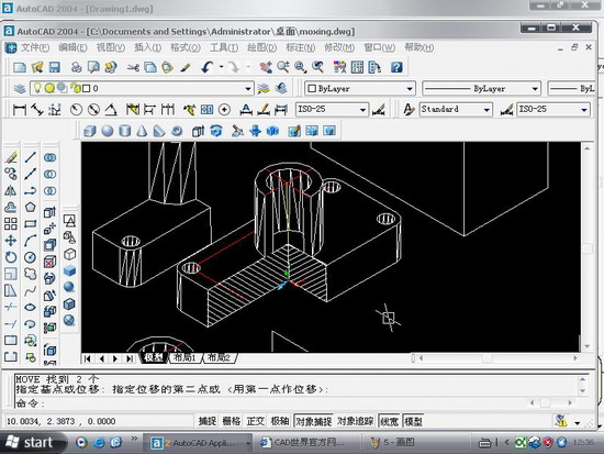
在cad如何做些剖切呢.今日写了一个教程,抛砖引玉,希望给大家点思路.随便做了一个模型,下面就来发张图片

图1

图2
用剖切面完全剖开机件所得的剖视图称为全剖视图。全剖视图用于外形简单内部结构较复杂且不对称的机件。
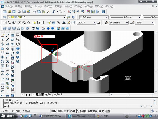
全剖.操作要点:xy,.XZ,YZ等平面的剖面都是依据你的ucs坐标来的,因此如果某些时候剖切得不到全剖效果的话,那就你的坐标系有问题.

图3
最后选择b,保留两侧,得到全剖效果

图4

图5
半剖模型:
当机件具有对称平面时,在垂直于对称平面的投影面上投射所得的图形,以对称中心线为界,一半画成剖视图,另一半画成视图,这种剖视图称为半剖视图。半剖视图适用于内外结构都需要表达且具有对称平面的机件。
画半剖视图应注意:
(1)视图和剖视的分界线应是细点画线,不能以粗实线分界。
(2)半剖视图中由于图形对称,机件的内部形状已在半个剖视图中表示清楚,所以在表达外部形状的半个视图中不画虚线,以及在后方不可见的虚线都不画。
(3)机件的形状接近于对称,且不对称部分已另有图形表达清楚时,也可以画成半剖视图。
(4)当对称机件的轮廓线与中心线重合时,不宜采用半剖视图表示。
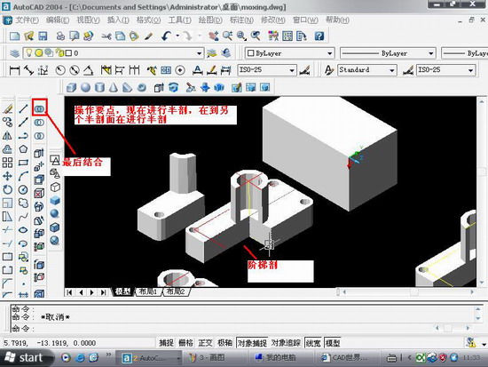
半剖的操作与阶梯剖有点相似.只不过阶梯剖的要做多条辅助线

图6

图7
局部剖:
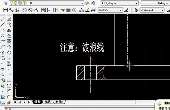
用剖切面局部地剖开机件,以波浪线或双折线为分界线,一部分画成视图以表达外形,其余部分画成剖视图以表达内部结构,这样所得的图形称为局部剖视图。它用于内外结构都需要表达且不对称的机件。
说明:补充资料仅用于学习参考,请勿用于其它任何用途。
参考词条