1) dry land


干河床
1.
To the dry land question, the "freezing" idea is taken into account.


采用有限体积法建立了平面二维水流数学模型,模型采用交错网格,对于干河床问题采用了“冻结法”思想。
2.
Due to complex topography condition, there is some difficulty to simulate flood routing on dry land, this paper a ”level tiled” method is proposed, and with which a better simulation result has got.
在地形较复杂的情况下 ,采用常用的处理干河床问题的方法有时会出现水流虚假流动的现象 。
2) sand river


(干)砂河(床)
3) dry wash


干河床<地>
4) The river bed is dry.


河床干涸了。
5) riverbed
[英]['rivəbed] [美]['rɪvɚ,bɛd]


河床
1.
Research and Implementation of Dynamic Updating and Spatial Analysis of Yangtze River Riverbed;
长江河床动态更新及空间分析的研究与实现
2.
Author especially mentions the application of soundless breaking agent to break rock in riverbed to ensure the safety and reliability of construction.
对玉门沟油库穿越河床段输油管道从施工准备到施工方法上进行了详细论述 ,并对施工的整个过程由修筑临时道路到管道沟槽开挖。
3.
According to the calculation results of general erosion of riverbed of bridge,this paper analyzes the impact of the main parameters in the formula to general erosion,gives the scope of application and defects of that formula,and proposes a suggestion on determination of general erosion depth.
根据桥位河床的一般冲刷计算成果,分析计算公式中主要参数对一般冲刷的影响,指出公式的适用范围和不足,提出确定一般冲刷深度的建议。
6) river bed


河床
1.
Observation and analysis of the river bed scour behind the third dam of Gutianxi;


古田溪三级大坝下游河床冲刷原型观测与分析
2.
This paper studied the formation of recent three strata underlying the river bed in the reaches from Taiqian of Henan to Weishan of Shandong according to the stratigraphic analysis and soil tests.
通过地层分析和室内土工试验等方法,研究了黄河下游河南台前至山东位山河段近代河床下伏的三层地层的成因,研究结果表明:上部黄色砂壤土层系1855a黄河铜瓦厢发生大改道后黄河新近冲洪积沉积物;中部黑色粘土层为湖积沉积物;下部黄色壤土层系古黄河冲洪积沉积物。
3.
Based on analysis about the situation of exploiting sand in recent ten years and the field data of river topography in recent thirty years in Fuyang reach of Fuchun River,the authors find that massive and irregular exploiting sand from the river bed has caused new problems.
根据钱塘江富春江富阳河段近 1 0年的采砂情况和近 30年的河道实测资料分析 ,发现大规模和无序采砂使得河床严重变形 ,纵剖面形成过度下凹型形态 ,影响到河势稳定。
补充资料:河床
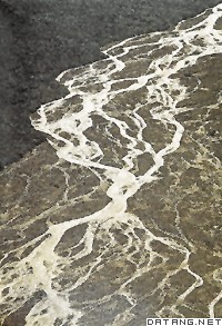
| 河床 river bed 河谷中平水期水流所占据的谷底部分。又称河槽。河床横剖面呈一低洼的槽形。纵剖面,在山区较陡,深槽与浅滩交替,多跌水、瀑布;平原区坡度较缓,微有起伏。平面形态:山区河床多狭窄顺直,岸线因山嘴突出而呈犬牙交错;平原区河床多弯曲或分汊。 河床纵剖面是从河源到河口的河床最低点的连线。该纵剖面的发展,受河流侵蚀基准面的控制。河流的下切面是无止境的,往往受某一基面控制,河流下切到接近这一平面后即失去侵蚀能力,不再向下侵蚀,这一平面称为河流侵蚀基准面。影响河床纵剖面发展的因素有气候、构造、岩性及环境变迁等。
河床的类型一般可分为4 类:①顺直微弯型,河段顺直略有弯曲、深槽、浅滩交错分布。②弯曲型,具有曲折的外形和蜿蜒蠕动的动态特性,分布很广,任意两相邻浅滩的间距约为河宽的5~7倍。③分汊型,又称江心洲型河床,具有一个或几个江心洲,河身呈莲藕状,具两股以上的汊道,汊道交替消长。④游荡型,河身顺直宽浅,沙滩众多,汊道交织,河床变形迅速,主槽摆动不定,水流散乱。 河床在水流作用下形成河床侵蚀地貌和堆积地貌。侵蚀地貌主要有深槽、壶穴、岩槛、深切曲流。当水流侵蚀能力增强,该段河床就被冲刷成深槽。在构造破碎带,节理发育与被湍急水流冲磨成的深穴称壶穴。可深达6~7米。横亘于河床底部上凸的坚硬岩石组成的坡坎称岩槛,常伴有瀑布或跌水。由于地壳抬升,深切到基岩之中的曲流称深切曲流。河床堆积地貌主要有河床展宽期间堆积的浅滩;布于岸边的边滩;布于河心的心滩,枯水位时露出水面,中水位以上出露的称江心洲。沿岸长条延伸的沙滩称沙嘴。边滩经生长,发育成河漫滩。河漫滩上随着动力作用的变化而发育多种类型的微地貌。(见河漫滩) |
说明:补充资料仅用于学习参考,请勿用于其它任何用途。
参考词条
