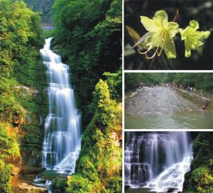
1) Bailian River Basin


白莲河流域
1.
Application of VIC Land Surface Hydrological Model in Flow Simulation of Bailian River Basin;
VIC陆面水文模型在白莲河流域径流模拟中的应用
2.
Both models are applied to the Bailian River basin in Hubei Province to discuss their adaptability in flow simulation of the medium or small basin and their effects are compared.
首先对VIC模型与SWAT模型进行了简介,然后将两个模型应用到湖北省白莲河流域,探讨其在中小流域尺度的径流模拟中的适用性,同时进行径流模拟的对比研究。
3.
The model was applied in Bailian River basin in Hubei Province to discuss its adaptability in flow simulation of the medium or small basin.
以湖北省白莲河流域为研究区,探讨了SWAT模型在中小流域尺度的径流模拟中的适用性,利用白莲河流域的水文气象数据、DEM数据、土壤类型和土地利用等资料建立了白莲河流域的SWAT模型,并选用1995~1999年汛期(4~10月)为模型参数的率定期、2002~2004年汛期(4~10月)为模型参数的检验期。
2) Malian River Basin


马莲河流域
1.
Digital terrain analysis of Malian River Basin based on DEM;


基于DEM的马莲河流域数字地形分析
3) Baihe watershed


白河流域
1.
Based on the landscape pattern of Baihe watershed in 2000 and atmosphere and runoff from 1990 to 2007 and the sediment and water quality from year 2001 to 2006, sensitive parameter have been analysised and calibrated and verified.
白河流域属于密云水库上游地区,是北京市主要供水水源地,其水质安全对北京生产生活起着重要的作用。
4) Chaobaihe River Basin


潮白河流域
1.
Soil and water conservation of reservoir watershed and its water yield:A case study of Chaobaihe River Basin on the upper reaches of Miyun Reservoir;
水库集水区水土保持与流域产水量——以密云水库上游潮白河流域为例
2.
Chaobaihe river basin is one of the main water sources in Beijing.


潮白河流域是北京市主要的供水源地之一,但是由于各种因素的影响,已经出现了沙化现象。
5) Baisha river drainage area


白沙河流域
1.
Taking the Baisha river which was the first level tributaries of the Tianquan river as the study object, the impact to landscape elements, landscape structure and landscape function of the small hydropower rundle development in Baisha river drainage area were analyzed by the numbers in this study.
本研究以岷江水系天全河一级支流——白沙河为研究对象,系统分析了白沙河流域小水电梯级开发的景观要素、景观结构与景观功能影响,构建了流域小水电梯级开发的景观影响综合评价体系,并运用构建的综合评价体系对白沙河流域小水电梯级开发的景观影响进行了评价。
6) Baideng River Basin


白登河流域
1.
Research on the Sustainable Agricultural Development of Baideng River Basin in Yanggao County
阳高县白登河流域可持续农业发展研究
补充资料:大关黄莲河

大关黄莲河
位于昭通市中部的大关县,属省级风景名胜区,可游览面积107平方公里。区内包括;黄莲河景区、青龙洞景区、罗汉坝景区。景区内飞瀑倒悬、秀丽多姿、气势雄壮,溶洞内千姿百态、仪态万方,森林神秘莫测、气势森森。该景区以瀑布群、溶洞和原始森林为其主要特色,兼之可实地品味 清朝贡品——翠华茶,更增加不少情趣。是消夏避暑、旅游度假的 良好所在。
说明:补充资料仅用于学习参考,请勿用于其它任何用途。