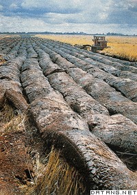
1) sandy land of west northeast plain


东北平原西部沙地
2) west of Northeast plain in China


东北平原西部
1.
The west of Northeast plain in China is a typical interlocking area between farming and stockbreeding , whose ecoenvironment is very fragile and vulnerable to environment change.
东北平原西部地区为草甸草原—草原过渡带,属典型的农牧交错区,生态环境脆弱,环境变化反映敏感。
3) The Middle-west of the Northeast China


东北地区中、西部
4) eastern part of Northwest China


西北地区东部
1.
Preliminary study is undertaken of the spring soil moisture variation in the eastern part of Northwest China based on the dekad soil moisture data of target agricultural meteorological stations from 1981 to 2001.
利用中国西北地区东部 (包括宁夏、内蒙古西部以及甘肃、陕西两省 35°N以北地区 )农业气象站近 2 0年固定地段旬土壤湿度资料 ,对该地区春季土壤湿度的变化进行了初步分析。
2.
Using the historical dust storms data from 1954-2001,the risk values of the occurrence of severe group dust-storms in eastern part of Northwest China were calculated.
利用1954-2001年的沙尘暴记录,对中国西北地区东部群发性强沙尘暴年内发生风险进行了计算。
3.
Based on the available original duststorms data from 60 meteorological observation stations, the paper constructed a quite complete series of severe group duststorms in the eastern part of Northwest China in 1954-2001.
利用1954~2001年60个站的气象实测资料,探讨了西北地区东部群发性强沙尘暴的认定标准,建立起该地区近48年较完整的群发性强沙尘暴序列,并初步分析了该地区群发性强沙尘暴的时空分布特征和年际变化。
5) the east of Northwest China


西北地区东部
1.
Using the method, the monthly Palmer moisture anomaly indexes of twenty wheat observation stations, such as Yan’an, Wuwei, Jingtai, Xining, Guide, Lanzhou etc, from 1961 to 2000 are calculated in the east of Northwest China, and the aridity and wetness of different period of growth for wheat.
根据Palmer气象干旱指数(PDSI)的中间量Palmer湿润指数原理,计算了西北地区东部冬小麦农气观测站延安、咸阳等多个站点1961—2000年逐月Palmer湿润指数,对各站点的冬小麦不同发育期的旱涝情况做了初步的验证和应用。
2.
Based on the theory of isentropic potential vorticity(IPV),a diagnostic analysis of a continuous rain process in the east of Northwest China in the second ten-day of May in 2005 was carried out.
应用等熵位涡原理,对2005年5月中旬西北地区东部的一次连阴雨过程进行了诊断分析。
6) The eastern region of northwest China


西北地区东部
1.
The guide of urban special structure form s rational increase and control measure are propitious to prevent urban space form spreading out of order, helping develop reasonable form of urban special structure and enhancing the comprehensive quality of citiesThe eastern region of northwest China, as the chiefly important development region .
西北地区东部作为西部大开发首要重点发展区域,处于工业化、城市化的加速时期,城市空间扩展迅速、结构形态变化剧烈。
2.
In the strategetic background of speeding up urbanism, the eastern region of northwest China, as the chiefly important development region in the Western Development, will face the fast urbanism.
西北地区东部作为西部大开发首要重点发展区域,在加速城市化战略背景下,将面临一个城市化快速发展时期。
3.
Middle and small cities in the eastern region of northwest China is the main body of the northwest region\'s city system,at the impact of rapid urbanization,the increasingly acute contradiction between development status and future sustainable development of city space,urgently need a reasonable structure and morphology form of city space to guide city spatial development.
西北地区东部中小城市作为西北地区东部城市体系的主体,在快速城市化冲击下,城市空间发展现状与其未来可持续发展之间的矛盾日益尖锐,亟待需要一种合理的城市空间结构与形态模式引导城市空间发展。
补充资料:东北平原
| 东北平原 位于中国大兴安岭、小兴安岭和长白山脉之间。又称关东平原、松辽平原。山岭外侧被额尔古纳河、黑龙江干流、乌苏里江、图们江和鸭绿江所环绕。向有山环水绕、沃野千里之称。南北长约1000千米,东西宽约400千米。面积 35万平方千米。是中国面积最大、地势最高的平原。属寒温带、温带季风气候 。冬季严寒漫长,积雪日数大约60~100天,积雪深度10~20厘米,冰冻期约200天。地带性土壤黑土,土层厚 35~60厘米,最厚在1米以上,有机质含量高。产大豆、春小麦、甜菜、土豆,产量居中国首位,还出产玉米、高粱、小米、水稻等。这里的水稻种植已达北纬50°以北地区,成为世界上水稻生产的最北界限。有狼、獾、狐、獐子、黄羊等野生动物活动。人参、貂皮、鹿茸是这里的三宝。有石油、煤、铁等矿产资源,发展了钢铁、煤炭、石油、机器制造、发电设备制造、造纸、化学等工业,是中国重要的工业基地。东北平原由东北角的三江平原、北部的松嫩平原和南部的辽河平原组成。三江平原沼泽荒地,过去为东北的北大荒,经过多年开垦,已成为中国最大的商品粮基地。辽河平原南部,过去为东北的南大荒,遍布沼泽化湿地和盐荒碱滩,1949年后 ,修建了大型电力排灌站,开垦荒地3万公顷,生产水稻,平均亩产400千克以上,成为山海关外的鱼米乡。平原大面积未开发,仍是一片草原。地势较高、排水良好的平缓地,草类繁多,当地称“五花草塘”;地势低平,地面无积水的地区,以小叶樟占优势,俗称“小叶樟塘”;地势低洼、地表常有积水的地方,以苔草为主;地势更低,地表经常有积水的沼泽地,生长各种水草,如乌拉草、芦苇、苔草、蒲草、荻草等。平原周围山岭水土流失严重,沙丘沙地分布广泛,近年来在北起黑龙江省的富裕县和甘南县,南到辽宁省新民县 ,营造了长800千米的防风固沙的草原防护林、农田防护林、水土保持林。
|
说明:补充资料仅用于学习参考,请勿用于其它任何用途。
参考词条
