1) Tulasi volcanic basin

吐拉苏火山盆地
1.
Hydrothermal fluids related to gold mineralization are rich in K+, Na+, F-, SO42-, O2 and N2 inside the Tulasi volcanic basin.
吐拉苏火山盆地中与金成矿有关的热液富含K+、Na+、F-、SO42-和N2、O2等,是一种主要来源于岩浆-火山的热液,有大气水参于的次生热液。
2) Tulasu Basin
吐拉苏盆地
3) the northwest of Tulasu basin
吐拉苏盆地西北部
4) Tula basin
吐拉盆地
1.
In view of types,abundances and thermal evolution properties on organic matter,an evaluation of the hydrocarbon source rocks of the lower and middle Jurassic in Tula basin is made.
通过对吐拉盆地中-下侏罗统烃源岩有机碳含量、可溶有机质含量、热解参数、干酪根显微组分、干酪根元素、干酪根炭同位素、镜质体反射率等方面的分析,讨论了烃源岩的有机质丰度、类型和成熟度。
2.
On the basis of biomarkers in the lower and middle Jurassic source rocks from the Tula basin,it can be seen that these samples at least have reached maturation stage during their thermal evolution,and the organic sources are mainly from terrestrial higher plant combined with abundant aquatic organisms input.
对吐拉盆地中下中-下侏罗统烃源岩饱和烃中正构烷烃、类异戊二烯烷烃、甾萜烷类化合物研究表明,研究样品的有机质演化至少处于成熟阶段,其母质来源以丰富的高等植物输入,同时也有一定比例的低等水生生物输入为特征,泥岩沉积时为微咸水较强还原沉积古环境。
3.
Tula basin is located among the southwestern Qaidam basin,the southeastern Tarim basin and the north of Kekexili mountain ranges,with above sea level of3000meters,being sparsely populated and very low mature explo-ration.
吐拉盆地是位于柴达木盆地西南、塔里木盆地东南、可可西里山脉以北的一个盆地,该盆地海拔3000m以上,人烟稀少,勘探程度很低。
5) volcanic basin
火山盆地
1.
Strike-slip pull-apart process and emplacement of Xiangshan uranium-producing volcanic basin;
走滑拉分作用与相山产铀火山盆地的就位
2.
Geological conditions for ore-forming process and prospecting direction of the U-Mo polymetallic deposits in Guyuan volcanic basin;
沽源火山盆地铀钼多金属成矿地质条件分析及找矿方向
3.
Lingquan volcanic basin is located in the mid-southern segment of known Rrguna-Kelulun Eastnorth-trending volcanic rocks uranium metallogenic belt,it is on the same belt with Telechuf Field of Russia and Durnuot Field of Mongolia.
灵泉火山盆地位于著名的额尔古纳—克鲁伦北东向火山岩铀成矿带中南段,与俄罗斯斯特列措夫铀矿田、蒙古多尔诺特铀矿田处于同一矿带上。
6) volcanic basin
火山岩盆地
1.
New discovery and understanding about seeking the copper-lead-zinc polymetal deposits in volcanic basin of east Guangdong;
粤东火山岩盆地铜-铅-锌多金属矿床找矿新发现与认识
2.
Correspondingly, basins in the region evolved from the marine basin of Sinian to middle Triassic,the arround Yangtze foreland basin of late Triassic to middle Jurassic, volcanic basins of late Jurassic to early Cretaceous to extensional basins of late Cretaceous to Eogene.
下扬子地区震旦纪以来经历了不同的大地构造与地球动力学背景 ,盆地演化相应地经历了震旦纪—中三叠世海盆→晚三叠世—中侏罗世沿江前陆盆地→晚侏罗世—早白垩世火山岩盆地→晚白垩世—早第三纪陆相伸展盆地。
3.
Zouping copper deposit locates in Zouping volcanic basin in south part of Qihe-Guangrao deep fault belt.
邹平铜矿处于齐河-广饶深大断裂带南部的邹平火山岩盆地中,形成于破火山口火山通道充填的石英正长闪长岩岩颈中央上部,包括伟晶岩型铜矿和细脉浸染状斑铜矿床两种类型。
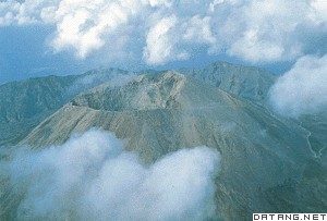
补充资料:维苏威火山
| 维苏威火山 Vesuvio 意大利南部活火山。维苏威奥斯卡语意为冒烟或烟的喷发。位于那不勒斯湾畔。海拔1280米(1970),每次喷发后高度都有变化。火山原系海湾中一小岛,后经一系列火山爆发堆积的喷出物将其与陆地连成一体。火山口是内壁直立的大圆洞。历史上长期为一休眠火山。公元79年突然喷发,将附近的庞培、斯塔比亚和赫库兰尼姆等城全部埋没。18世纪开始对该火山进行科学研究,在海拔608米处建立观测站。考古学家从火山灰堆中将庞培城发掘出来。废墟上昔日的街道、井泉与浴池等完整如故。维苏威火山活动可分为喷发期和静止期。公元79年至1631年间喷发过8次,经过几个世纪的静止期,1631年12月16日又发生大喷发,5座城镇被毁,约4000死亡。1660~1944年间共经历20次大喷发。每一喷发期长达6 ~369个月;静止期以喷发后火山口封闭为标志。自公元79年大喷发以后 ,除1037~1630年长达几个世纪停息外,一直处于喷发期与静止期的交替之中 。1964年5月11日的喷发表明,火山进入了新的喷发期。维苏威火山灰形成的土壤,十分肥沃。山麓遍布葡萄园和柑橘园,所产葡萄酒最闻名。古代庞培的酒坛上多刻有“维苏威”字样。现在山麓北部为小农业中心,沿那不勒斯湾海岸分布有工业城镇。火山西北的那不勒斯是意大利仅次于热那亚的第二大港口城市,是工业中心和旅游名城。维苏威火山地区是意大利南部风景区之一,有200多万人居住在这里。为了发展旅游事业,从那不勒斯到山脚,建有电气火车,缆车可直达山顶火山口。
|
说明:补充资料仅用于学习参考,请勿用于其它任何用途。
参考词条