1) polar tilt angle


极化倾角
1.
This(paper) presented a parameter estimation technique of polar tilt angle and azimuthal orientation angle of BAM images according to the variations of analyzer angles.
利用检偏角的变化,对布儒斯特显微镜(BAM)图像像素点所代表分子簇的极化倾角和取向方位角进行了参数估计。
2) dip of polarization ellipse


极化椭圆的倾角
3) all magnetic latitude variable inclination turning to the pole


全磁纬变倾角化极
1.
On the basis of 1:200000 gravity and magnetic results in Haijiao-Qiantang area in the East China Sea, using wavelet analysis and all magnetic latitude variable inclination turning to the pole, the distribution of pre-Cenozoic layer and the petroleum resources are discussed.
基于东海海礁钱塘地区1:20万重磁成果,采用小波多尺度分解、全磁纬变倾角化极等技术,对该地区前新生代地层的展布与含油气远景进行了探讨。
4) the Dipole Moment Tilt Angle


偶极矩倾角
5) overturning limit angle


倾斜极限角
6) maximum turned angle


极限翻倾角
补充资料:磁倾角
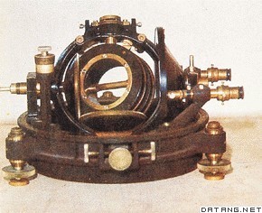
| 磁倾角 geomagnetic inclination 地球表面任一点的地磁场总强度的矢量方向与水平面的夹角。将一个具有水平轴的可旋转磁针制做得内部质量完全均匀对称,使其在磁屏蔽空间中自然地保持水平。观测时使其水平轴与当地磁子午面垂直,这时磁针指北极N所指的方向即为地磁场总强度的矢量方向,它与水平面的夹角即为当地的磁倾角。这种磁针称为磁倾针。规定磁倾针的指北极N向下倾为正。一般结果是,北半球的磁倾角为正,南半球的磁倾角为负。将磁倾角为零的地点连结起来,此线称为磁倾赤道,与地球赤道比较接近。
|
说明:补充资料仅用于学习参考,请勿用于其它任何用途。
参考词条
