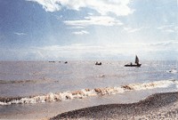
1) the plain in the north of the Xingkai Lake


兴凯湖北部平原
1.
There are few studies on development of the plain in the north of the Xingkai Lake,Heilongjiang province,China,especially on formation of its wetlands.
兴凯湖北部平原和湿地的形成与发展,过去研究的较少。
2) Northwest of Taihu Lake Plain


太湖平原西北部
1.
The Quaternary Marine Transgression in the Northwest of Taihu Lake Plain;


太湖平原西北部第四纪海侵
3) Xingkai Lake


兴凯湖
1.
Study on lowest water level of Xingkai Lake for ecological safety;


兴凯湖最低生态安全水位研究
2.
Foraging Habitat of Red-crowned Crane in Autumn in Xingkai Lake;


兴凯湖秋季丹顶鹤觅食生境初步研究
3.
Growth pattern of topmouth culter (Erythroculter ilishaeformis) in Xingkai Lake;


兴凯湖翘嘴红鲌生长式型的研究
4) Daxingkai Lake


大兴凯湖
1.
The population structure of zooplankton in Daxingkai Lake;


大兴凯湖浮游动物群落结构及生物多样性
5) Pinus takahassii


兴凯湖松
6) the North Plain


北部平原
1.
Groundwater flow modelling in the North Plain of the Urumqi River Basin


乌鲁木齐河流域北部平原地下水流模拟
补充资料:兴凯湖
| 兴凯湖 在中国黑龙江省东南部,中、俄两国边界上,北部属中国,南部属俄罗斯。湖面海拔69米,湖水面积4380平方千米。兴凯湖风光有9条短小河流汇入,蓄水量27.1亿立方米。最深处约10米。湖水由北部流出,通过松阿察河流向东北注入乌苏里江。北有小兴凯湖,面积约140平方千米,两湖之间隔有一条1千米宽的沙坝,高水位时,两湖相通。湖中富产鱼类。湖周围地势低平,土壤肥沃,大部分已辟为中国大型商品粮基地。
|
说明:补充资料仅用于学习参考,请勿用于其它任何用途。
参考词条
